Myjava: Difference between revisions
RodRabelo7 (talk | contribs) |
Updated infobox |
||
| Line 1: | Line 1: | ||
{{Infobox settlement |
{{Infobox settlement |
||
| name |
| name = Myjava |
||
| |
| other_name = |
||
| |
| settlement_type = [[List of municipalities and towns in Slovakia|Municipality]] |
||
| ⚫ | |||
<!-- images, nickname, motto --> |
<!-- images, nickname, motto --> |
||
| image_skyline |
| image_skyline = Myjavacentrum.jpg |
||
| image_caption |
| image_caption = |
||
| image_flag |
| image_flag = Myjava-myjava-flag.svg |
||
| image_shield |
| image_shield = Coat of Arms of Myjava.svg |
||
| ⚫ | |||
| nickname = |
|||
| etymology = |
|||
<!-- location --> |
<!-- location --> |
||
| subdivision_type |
| subdivision_type = [[List of sovereign states|Country]] |
||
| subdivision_name |
| subdivision_name = {{SVK}} |
||
| subdivision_type1 |
| subdivision_type1 = [[Regions of Slovakia|Region]] |
||
| subdivision_name1 |
| subdivision_name1 = {{flag|Trenčín Region}} |
||
| subdivision_type2 |
| subdivision_type2 = [[Districts of Slovakia|District]] |
||
| subdivision_name2 |
| subdivision_name2 = [[Myjava District]] |
||
| subdivision_type3 = District |
|||
| subdivision_name3 = [[Myjava District|Myjava]] |
|||
| subdivision_type4 = |
|||
| subdivision_name4 = |
|||
<!-- maps and coordinates --> |
<!-- maps and coordinates --> |
||
| |
| pushpin_map = Slovakia Trenčín Region#Slovakia |
||
| |
| pushpin_relief = 1 |
||
| ⚫ | |||
| pushpin_map = Slovakia Trenčín Region#Slovakia |
|||
| ⚫ | |||
| pushpin_relief = 1 |
|||
| ⚫ | |||
| ⚫ | |||
| ⚫ | |||
| ⚫ | |||
| |
| leader_name = Pavel Halabrín |
||
| ⚫ | |||
| ⚫ | |||
| ⚫ | |||
| leader_name = Pavel Halabrín |
|||
<!-- established --> |
<!-- established --> |
||
| established_title |
| established_title = First mentioned |
||
| established_date |
| established_date = 1262 |
||
<!-- area --> |
<!-- area --> |
||
| area_footnotes |
| area_footnotes = <ref name="area">{{Cite web |url=http://datacube.statistics.sk/#!/view/sk/VBD_DEM/om7014rr/v_om7014rr_00_00_00_sk |title=Hustota obyvateľstva - obce [om7014rr_ukaz: Rozloha (Štvorcový meter)] |language=sk |date=2022-03-31 |website=www.statistics.sk |publisher= Statistical Office of the Slovak Republic|access-date=2022-03-31}}</ref> |
||
| area_total_km2 |
| area_total_km2 = 48.54 |
||
| area_total_sq_mi = |
|||
| area_land_sq_mi = |
|||
| area_water_sq_mi = |
|||
<!-- elevation --> |
<!-- elevation --> |
||
| ⚫ | | elevation_footnotes = <ref name="base_info">{{Cite web |url=http://datacube.statistics.sk/#!/view/sk/VBD_SK_WIN/om5001rr/v_om5001rr_00_00_00_sk |title=Základná charakteristika |language=sk |date=2015-04-17 |website=www.statistics.sk |publisher= Statistical Office of the Slovak Republic|access-date=2022-03-31}}</ref> |
||
| elevation_footnotes = |
|||
| ⚫ | |||
| ⚫ | | |
||
<!-- population --> |
|||
| elevation_ft = 1,027<ref name="base_info"/> |
|||
| population_as_of |
| population_as_of = {{abbr|2021|Population: 2021-12-31. Population density & Total area: 2021-06-30/-07-01. Elevation, Postal code & Area code (last updated): 2015-04-17.}} |
||
| population_footnotes |
| population_footnotes = <ref>{{Cite web |url=http://datacube.statistics.sk/#!/view/sk/VBD_DEM/om7101rr/v_om7101rr_00_00_00_sk |title=Počet obyvateľov podľa pohlavia - obce (ročne) |language=sk |date=2022-03-31 |website=www.statistics.sk |publisher= Statistical Office of the Slovak Republic|access-date=2022-03-31}}</ref> |
||
| population_total |
| population_total = 10626 |
||
| population_density_km2 = auto |
|||
| population_density_sq_mi = |
|||
| population_demonym = |
|||
<!-- time zone(s) --> |
<!-- time zone(s) --> |
||
| timezone1 |
| timezone1 = [[Central European Time|CET]] |
||
| utc_offset1 |
| utc_offset1 = +1 |
||
| timezone1_DST |
| timezone1_DST = [[Central European Summer Time|CEST]] |
||
| utc_offset1_DST |
| utc_offset1_DST = +2 |
||
<!-- postal codes, area code --> |
<!-- postal codes, area code --> |
||
| postal_code_type |
| postal_code_type = Postal code |
||
| postal_code |
| postal_code = 907 01<ref name="base_info"/> |
||
| |
| area_code = +421 34<ref name="base_info"/> |
||
| |
| blank_name = [[Slovak car registration plates|Car plate]] |
||
| |
| blank_info = MY |
||
| iso_code = |
|||
| blank_name = [[Slovak car registration plates|Car plate]] |
|||
| blank_info = MY |
|||
<!-- website, footnotes --> |
<!-- website, footnotes --> |
||
| website |
| website = {{URL|https://www.myjava.sk/}} |
||
| footnotes = |
|||
|area_note= ({{Tooltip|2022|2022-06-31/2022-07-01}}) |
|||
}} |
}} |
||
'''Myjava''' ({{IPA|sk|ˈmijaʋa}}; historically also Miava, {{langx|de|Miawa}}, {{langx|hu|Miava}}) is a town in [[Trenčín Region]], [[Slovakia]]. |
'''Myjava''' ({{IPA|sk|ˈmijaʋa}}; historically also Miava, {{langx|de|Miawa}}, {{langx|hu|Miava}}) is a town in [[Trenčín Region]], [[Slovakia]]. |
||
| Line 107: | Line 87: | ||
{{Wikivoyage|Myjava}} |
{{Wikivoyage|Myjava}} |
||
{{commons category-inline|Myjava}} |
{{commons category-inline|Myjava}} |
||
* [http://www.myjava.sk Official website] |
|||
{{Myjava District}} |
{{Myjava District}} |
||
{{authority control}} |
{{authority control}} |
||
Revision as of 01:40, 10 May 2025
Myjava | |
|---|---|
 | |
Location of Myjava in the Trenčín Region Location of Myjava in Slovakia | |
| Coordinates: 48°45′N 17°34′E / 48.75°N 17.56°E | |
| Country | |
| Region | |
| District | Myjava District |
| First mentioned | 1262 |
| Government | |
| • Mayor | Pavel Halabrín |
| Area | |
• Total | 48.54 km2 (18.74 sq mi) |
| Elevation | 313 m (1,027 ft) |
| Population (2021)[3] | |
• Total | 10,626 |
| Time zone | UTC+1 (CET) |
| • Summer (DST) | UTC+2 (CEST) |
| Postal code | 907 01[2] |
| Area code | +421 34[2] |
| Car plate | MY |
| Website | www |
Myjava (Slovak pronunciation: [ˈmijaʋa]; historically also Miava, German: Miawa, Hungarian: Miava) is a town in Trenčín Region, Slovakia.
Geography
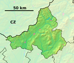
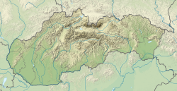
It is located in the Myjava Hills at the foothills of the White Carpathians and nearby the Little Carpathians. The river Myjava flows through the town. It is 10 km away from the Czech border, 35 km from Skalica and 100 km from Bratislava.
History
The settlement was established in 1533 and was colonized by two groups of inhabitants: refugees fleeing from the Ottomans in southern Upper Hungary (today mostly Slovakia) and inhabitants from north-western and northern Upper Hungary.
During the Revolutions of 1848, the first Slovak National Council met in the town as a result of the Slovak Uprising. Today, the house of their meeting is now part of the Museum of the Slovak National Councils, a part of the Slovak National Museum network.
Before the establishment of independent Czechoslovakia in 1918, Myjava was part of Nyitra County within the Kingdom of Hungary. From 1939 to 1945, it was part of the Slovak Republic. On 8 April 1945, the Red Army dislodged the Wehrmacht from Myjava and it was once again part of Czechoslovakia.
Demographics
| Year | Pop. | ±% |
|---|---|---|
| 1970 | 9,227 | — |
| 1980 | 11,668 | +26.5% |
| 1991 | 13,135 | +12.6% |
| 2001 | 13,142 | +0.1% |
| 2011 | 12,330 | −6.2% |
| 2021 | 10,985 | −10.9% |
| Source: Censuses[4][5] | ||
According to the 2001 census, 95.5% of the inhabitants were Slovaks, 1.5% Czechs and 0.4% Roma.[6] The religious makeup was 51.4% Lutherans, 28.2% people with no religious affiliation and 14.2% Roman Catholics.[6]
Twin towns — sister cities
 Dolní Němčí, Czech Republic
 Kostelec nad Orlicí, Czech Republic
 Flisa, Norway
 Åsnes, Norway
 Janošik, Serbia
 Oroszlány, Hungary
 Little Falls, NY[8]
References
- ^ "Hustota obyvateľstva - obce [om7014rr_ukaz: Rozloha (Štvorcový meter)]". www.statistics.sk (in Slovak). Statistical Office of the Slovak Republic. 2022-03-31. Retrieved 2022-03-31.
- ^ a b c "Základná charakteristika". www.statistics.sk (in Slovak). Statistical Office of the Slovak Republic. 2015-04-17. Retrieved 2022-03-31.
- ^ "Počet obyvateľov podľa pohlavia - obce (ročne)". www.statistics.sk (in Slovak). Statistical Office of the Slovak Republic. 2022-03-31. Retrieved 2022-03-31.
- ^ "Statistical lexikon of municipalities 1970-2011" (PDF) (in Slovak).
- ^ "Census 2021 - Population - Basic results". Statistical Office of the Slovak Republic. 2021-01-01.
- ^ a b "Municipal Statistics". Statistical Office of the Slovak Republic. Retrieved 2007-11-06.
- ^ "Hodnotiaca správa programového rozpočtu mesta Myjava k 31. 12. 2018" (PDF). myjava.sk (in Slovak). Myjava. p. 20 (53). Retrieved 2019-09-05.
- ^ "Sister City signs spring up around Little Falls". Little Falls (N.Y.) Times Telegraph. August 26, 2016. Retrieved November 27, 2022.
External links
![]() Media related to Myjava at Wikimedia Commons
Media related to Myjava at Wikimedia Commons


