Module:Location map/data/USA: Difference between revisions
Appearance
Content deleted Content added
Marksize=5 |
|||
| Line 4: | Line 4: | ||
y = '50.0 + 1.6155950752393982 * 124.03149777329222 * ( 0.02613325650382181 - (1.3236744353715044 - (1.9694462586094064 - ($1 * pi / 180)) * cos(0.6010514667026994 * ($2 + 96) * pi / 180)))', |
y = '50.0 + 1.6155950752393982 * 124.03149777329222 * ( 0.02613325650382181 - (1.3236744353715044 - (1.9694462586094064 - ($1 * pi / 180)) * cos(0.6010514667026994 * ($2 + 96) * pi / 180)))', |
||
mark = 'Locator_Dot.svg', |
mark = 'Locator_Dot.svg', |
||
marksize = 5, |
|||
image = 'Usa edcp location map.svg', |
image = 'Usa edcp location map.svg', |
||
image1 = 'Usa edcp relief location map.png' |
image1 = 'Usa edcp relief location map.png' |
||
Revision as of 07:03, 4 April 2016
| This Lua module is used on approximately 115,000 pages. To avoid major disruption and server load, any changes should be tested in the module's /sandbox or /testcases subpages, or in your own module sandbox. The tested changes can be added to this page in a single edit. Consider discussing changes on the talk page before implementing them. |
| name | USA | ||
|---|---|---|---|
| x | 50.0 + 124.03149777329222 * ((1.9694462586094064-($1 * pi / 180)) * sin(0.6010514667026994 * ($2 + 96) * pi / 180)) | ||
| y | 50.0 + 1.6155950752393982 * 124.03149777329222 * ( 0.02613325650382181 - (1.3236744353715044 - (1.9694462586094064 - ($1 * pi / 180)) * cos(0.6010514667026994 * ($2 + 96) * pi / 180))) | ||
| image | Usa edcp location map.svg
| ||

| |||
| image1 | Usa edcp relief location map.png
| ||

| |||
| mark | Locator_Dot.svg
| ||
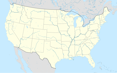
Module:Location map/data/USA is a location map definition used to overlay markers and labels on an equidistant conic projection map of the United States. The markers are placed by latitude and longitude coordinates on the default map or a similar map image.
Usage
These definitions are used by the following templates when invoked with parameter "USA":
{{Location map|USA |...}}{{Location map many|USA |...}}{{Location map+|USA |...}}{{Location map~|USA |...}}
Map definition
name = USA- Name used in the default map caption
image = Usa edcp location map.svg- The default map image, without "Image:" or "File:"
image1 = Usa edcp relief location map.png- An alternative map image, usually a relief map, which can be displayed via the relief or AlternativeMap parameters
x = 50.0 + 124.03149777329222 * ((1.9694462586094064-($1 * pi / 180)) * sin(0.6010514667026994 * ($2 + 96) * pi / 180))- An expression to calculate a location on the map via its longitude; evaluates as 0 along the left edge and 100 along the right edge
y = 50.0 + 1.6155950752393982 * 124.03149777329222 * ( 0.02613325650382181 - (1.3236744353715044 - (1.9694462586094064 - ($1 * pi / 180)) * cos(0.6010514667026994 * ($2 + 96) * pi / 180)))- An expression to calculate a location on the map via its latitude; evaluates as 0 along the top edge and 100 along the bottom edge
mark = Locator_Dot.svg ( )
)- The default mark image to display with this map. This can be overridden by the
markparameter in Template:Location map, which would otherwise default to Red pog.svg ( ).
).
- The default mark image to display with this map. This can be overridden by the
Alternative map
The {{Location map}}, {{Location map many}}, and {{Location map+}} templates have parameters to specify an alternative map image. The map displayed as image1 can be used with the relief or AlternativeMap parameters. Examples may be found below or in the following:
- Template:Location map#Relief parameter
- Template:Location map+/relief
- Template:Location map#AlternativeMap parameter
- Template:Location map+/AlternativeMap
Examples using location map templates
Location map, using default map (image)
{{Location map | USA
| width   = 250
| label   = Washington, D.C.
| lat_deg = 38.89
| lon_deg = -77.04
}}
Location map many, using relief map (image1)
Two locations in the United States
{{Location map many | USA
| relief   = yes
| width    = 250
| caption  = Two locations in the United States
| label1   = Washington, D.C.
| lat1_deg = 38.89
| lon1_deg = -77.04
| label2   = Seattle
| lat2_deg = 47.61
| lon2_deg = -122.33
}}
Location map+, using AlternativeMap
Two locations in the United States
{{Location map+ | USA
| AlternativeMap = Usa edcp relief location map.png
| caption = Two locations in the United States
| width   = 250
| places  =
  {{Location map~ | USA
  | label   = Washington, D.C.
  | lat_deg = 38.89
  | lon_deg = -77.04
  }}
  {{Location map~ | USA
  | label   = Seattle
  | lat_deg = 47.61
  | lon_deg = -122.33
  }}
}}
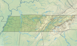
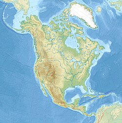
Location map, one location on three maps
{{Location map | USA#USA Tennessee#North America
| relief  = yes
| width   = 250
| lat_deg = 36.167
| lon_deg = -86.783
| label   = Nashville
}}
Location map, three maps and three captions
{{Location map | USA#USA Tennessee#North America
| relief  = yes
| width   = 250
| lat_deg = 36.167
| lon_deg = -86.783
| label   = Nashville
| caption = Location in the [[United States]]##Location in [[Tennessee]]##Location in [[North America]]
}}
See also
Location map templates
- Template:Location map, to display one mark and label using latitude and longitude
- Template:Location map many, to display up to nine marks and labels
- Template:Location map+, to display an unlimited number of marks and labels
Creating new map definitions
return {
	name = 'USA',
	x = '50.0 + 124.03149777329222 * ((1.9694462586094064-($1 * pi / 180)) * sin(0.6010514667026994 * ($2 + 96) * pi / 180))',
	y = '50.0 + 1.6155950752393982 * 124.03149777329222 * ( 0.02613325650382181 - (1.3236744353715044 - (1.9694462586094064 - ($1 * pi / 180)) * cos(0.6010514667026994 * ($2 + 96) * pi / 180)))',
	mark  =  'Locator_Dot.svg',
	image = 'Usa edcp location map.svg',
	image1 = 'Usa edcp relief location map.png'
}


