Aduku: Difference between revisions
Appearance
Content deleted Content added
JJMC89 bot (talk | contribs) Migrate {{Infobox settlement}} coordinates parameters to {{Coord}}, see Wikipedia:Coordinates in infoboxes |
Rescuing 1 sources and tagging 0 as dead. #IABot (v1.4beta4) |
||
| Line 35: | Line 35: | ||
}} <!-- Infobox ends !--> |
}} <!-- Infobox ends !--> |
||
'''Aduku''' is a town in, [[Apac District]] in northern [[Uganda]]. It is one of the municipalities within Apac District.<ref>{{cite web |
'''Aduku''' is a town in, [[Apac District]] in northern [[Uganda]]. It is one of the municipalities within Apac District.<ref>{{cite web |
||
url=http://www.newvision.co.ug/D/8/13/693084|title=MPS Warn On New Town Councils|accessdate=18 July 2015|date=1 September 2009 | |
|url=http://www.newvision.co.ug/D/8/13/693084 |
||
|title=MPS Warn On New Town Councils |
|||
|accessdate=18 July 2015 |
|||
|date=1 September 2009 |
|||
|last=Cyprian Musoke |
|||
|first=and Joyce Namutebi |
|||
|location=Kampala |
|||
|newspaper=[[New Vision]] |
|||
|deadurl=yes |
|||
|archiveurl=https://web.archive.org/web/20150226195203/http://www.newvision.co.ug/D/8/13/693084 |
|||
|archivedate=26 February 2015 |
|||
}}</ref> |
|||
==Location== |
==Location== |
||
Revision as of 07:31, 27 June 2017
Aduku | |
|---|---|
| Coordinates: 02°01′10″N 32°43′12″E / 2.01944°N 32.72000°E | |
| Country | Uganda |
| District | Apac District |
| Population (2009 Estimate) | |
• Total | 10,700 |
| Time zone | UTC+3 (EAT) |
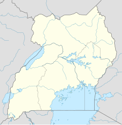
Aduku is a town in, Apac District in northern Uganda. It is one of the municipalities within Apac District.[1]
Location
Aduku is located approximately 36 kilometres (22 mi), by road, southwest of Lira, the largest city in the sub-region.[2] Aduku is located about 24 kilometres (15 mi), by road, east of Apac, the district headquarters.[3] The coordinates of the town are:2°01'10.0"N, 32°43'12.0"E (Latitude:2.0194; Longitude:32.7200).[4]
Points of interest
The following points of interest lie within the town limits or near its boundaries:
- Aduku Central Market
- Aduku Senior Secondary School - A public, mixed high school
- Aduku UCC (Uganda College of Commerce) - A public institution
- Ikwera Girls Secondary School - A public all-girls high school
- West Lango Anglican Diocese
- A branch of Stanbic Bank
- Rwekunye–Apac–Aduku–Lira–Kitgum–Musingo Road passes through the middle of town.
See also
References
- ^ Cyprian Musoke, and Joyce Namutebi (1 September 2009). "MPS Warn On New Town Councils". New Vision. Kampala. Archived from the original on 26 February 2015. Retrieved 18 July 2015.
{{cite web}}: Unknown parameter|deadurl=ignored (|url-status=suggested) (help) - ^ GFC, . (18 July 2015). "Road Distance Between Lira And Aduku With Map". Globefeed.com (GFC). Retrieved 18 July 2015.
{{cite web}}:|first=has numeric name (help) - ^ GFC, . (18 July 2015). "Map Showing Apac And Aduku With Route Marker". Globefeed.com (GFC). Retrieved 18 July 2015.
{{cite web}}:|first=has numeric name (help) - ^ "Location of Aduku At Google Maps" (Map). Google Maps.


