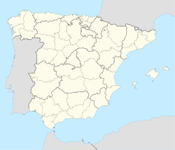
Daimiel
This article needs additional citations for verification. (December 2009) |
Daimiel | |
|---|---|
Municipality | |
| Coordinates: 39°4′20″N 3°36′52″W / 39.07222°N 3.61444°W | |
| Country | |
| Autonomous Community | |
| Province | Ciudad Real |
| Comarca | Campo de Calatrava |
| Government | |
| • Mayor | Leopoldo Jerónimo Sierra Gallardo (PP) |
| Area | |
| • Total | 438 km2 (169 sq mi) |
| Elevation (AMSL) | 627 m (2,057 ft) |
| Population (2018)[1] | |
| • Total | 18,051 |
| • Density | 41/km2 (110/sq mi) |
| Time zone | UTC+1 (CET) |
| • Summer (DST) | UTC+2 (CEST (GMT +2)) |
| Postal code | 13250 |
| Area code | +34 (Spain) + 926 (Ciudad Real) |
| Website | www.daimiel.es |
Daimiel is a municipality in Ciudad Real, Castile-La Mancha, Spain. It has a population of 17,342, and a mechanical industry.[2] The football club is Daimiel CF. The Tablas de Daimiel National Park, a well-known but endangered wetland natural reserve, lies partly within the boundaries of the town.
History
Daimiel is the location of the Motilla del Azuer, a Bronze Age fortification.
The "Martyrs of Daimiel" were killed here in 1936 during the Spanish Civil War.
References
- ^ Municipal Register of Spain 2018. National Statistics Institute.
- ^ "Vestas restarts Spanish blade factory after Coronavirus measures approved". Recharge | Latest renewable energy news. 23 March 2020.


