
Interstate 5 in California: Difference between revisions
Citation bot (talk | contribs) m Citation maintenance. [U]Removed redundant parameters. You can use this bot yourself! Please report any bugs. |
Skyman9999 (talk | contribs) →History: I wanted to add some information, but it was difficult to know where to put it when section is divided up based on event. So I changed it based on region. |
||
| Line 58: | Line 58: | ||
==History== |
==History== |
||
{{Expand |date=December 2008}} |
{{Expand |date=December 2008}} |
||
| ⚫ | The Golden State Freeway was proposed by the [[California Highway Commission]] in 1953. The proposal drew strong criticism from [[East Los Angeles]] residents as it would dissect and eliminate large residential and commercial areas of [[Boyle Heights]] and Hollenbeck Heights.<ref name=MRP1>{{cite book | last =Chavez | first =Ernesto | title ="Mi raza primero!" (My people first!) | publisher =[[University of California Press]] | date =2002 | location = | pages =25–26 | isbn =0520230183}}</ref><ref name=PCWF1>{{cite book | last =Avila | first =Erik | title =Popular Culture in the Age of White Flight | publisher =University of California Press | date =2006 | location = | pages =208–212 | isbn =0520248112}}</ref> The proposal also seemed to indicate a disregard for the ethnic [[Mexican American]] population of metropolitan Los Angeles. The "Boyle-Hollenbeck Anti-Golden State Freeway Committee" was formed for the purpose in blocking or re-routing the freeway. Then-[[Los Angeles City Council]] member [[Edward R. Roybal]] chaired that committee.<ref name=MRP1/> Despite this opposition, the construction of the freeway went ahead. |
||
| ⚫ | |||
===Historical naming in California=== |
===Historical naming in California=== |
||
| Line 70: | Line 66: | ||
In [[California]], the former western branch of Interstate 5 (the northern end of the spur into the [[San Francisco Bay Area|Bay Area]]) connecting [[Interstate 80 (California)|Interstate 80]] out of [[Vacaville, California|Vacaville]] to near [[Dunnigan, California|Dunnigan]], previously known as '''Interstate 5W''', was renamed [[Interstate 505 (California)|Interstate 505]]. Interstate 580 running between I-5 and I-80 was also once designated 5W; what is now I-5 (the stretch that runs through Sacramento) had been originally designated '''Interstate 5E'''. |
In [[California]], the former western branch of Interstate 5 (the northern end of the spur into the [[San Francisco Bay Area|Bay Area]]) connecting [[Interstate 80 (California)|Interstate 80]] out of [[Vacaville, California|Vacaville]] to near [[Dunnigan, California|Dunnigan]], previously known as '''Interstate 5W''', was renamed [[Interstate 505 (California)|Interstate 505]]. Interstate 580 running between I-5 and I-80 was also once designated 5W; what is now I-5 (the stretch that runs through Sacramento) had been originally designated '''Interstate 5E'''. |
||
=== |
===Los Angeles Area=== |
||
| ⚫ | The Golden State Freeway was proposed by the [[California Highway Commission]] in 1953. The proposal drew strong criticism from [[East Los Angeles]] residents as it would dissect and eliminate large residential and commercial areas of [[Boyle Heights]] and Hollenbeck Heights.<ref name=MRP1>{{cite book | last =Chavez | first =Ernesto | title ="Mi raza primero!" (My people first!) | publisher =[[University of California Press]] | date =2002 | location = | pages =25–26 | isbn =0520230183}}</ref><ref name=PCWF1>{{cite book | last =Avila | first =Erik | title =Popular Culture in the Age of White Flight | publisher =University of California Press | date =2006 | location = | pages =208–212 | isbn =0520248112}}</ref> The proposal also seemed to indicate a disregard for the ethnic [[Mexican American]] population of metropolitan Los Angeles. The "Boyle-Hollenbeck Anti-Golden State Freeway Committee" was formed for the purpose in blocking or re-routing the freeway. Then-[[Los Angeles City Council]] member [[Edward R. Roybal]] chaired that committee.<ref name=MRP1/> Despite this opposition, the construction of the freeway went ahead. |
||
| ⚫ | |||
===Newhall Pass=== |
|||
{{main|Newhall Pass interchange}} |
{{main|Newhall Pass interchange}} |
||
In the evening of [[October 12]], [[2007]], two trucks collided in the southbound tunnel that takes the [[truck bypass]] roadway under the main lanes near the [[Newhall Pass interchange]]. Fifteen trucks caught fire, killing three people and injuring 10.<ref>[http://cbs2.com/local/local_story_286115312.html cbs2.com - I-5 Closure May Last Until Tuesday<!-- Bot generated title -->]</ref><ref>[http://www.cnn.com/2007/US/10/13/tunnel.fire/index.html Investigators advance into tunnel after deadly inferno - CNN.com<!-- Bot generated title -->]</ref> |
In the evening of [[October 12]], [[2007]], two trucks collided in the southbound tunnel that takes the [[truck bypass]] roadway under the main lanes near the [[Newhall Pass interchange]]. Fifteen trucks caught fire, killing three people and injuring 10.<ref>[http://cbs2.com/local/local_story_286115312.html cbs2.com - I-5 Closure May Last Until Tuesday<!-- Bot generated title -->]</ref><ref>[http://www.cnn.com/2007/US/10/13/tunnel.fire/index.html Investigators advance into tunnel after deadly inferno - CNN.com<!-- Bot generated title -->]</ref> |
||
=== |
===Sacramento Area=== |
||
{{context}} |
{{context}} |
||
The section of I-5 running through [[downtown Sacramento]] is typically referred to by [[Caltrans]] as the "Boat Section" due to constant need for repair work and flooding issues.<ref name="Boat Section History">{{cite web|url=http://fixi5.com/history.html|title=Boat Section History|publisher=Fix I-5 Project|accessdate=2008-12-29}}</ref> Caltrans began working on the Boat Section during the 1960s and 1970s, draining the water from the area, creating a water pump system, building a retaining wall to protect the freeway from the [[Sacramento River]]. It was recently found that sand and silt from the [[Sacramento River]] were creating blockages in the drainage system that protected I-5.<ref name="Boat Section History" /> Major work repair of the "Boat Section" in [[Sacramento, California|Sacramento]] began in May 30, 2008.<ref name="Fix I-5 - What's Happening?">{{cite web|url=http://fixi5.com/about.html|title=What's Happening?|publisher=Fix I-5|accessdate=2008-12-29}}</ref> The construction was to take 40 days to complete and would require complete northbound and southbound closures on an alternating schedule. This section had major problems since being built, including being flooded in {{convert|15|ft|m}} of water in 1980. |
The section of I-5 running through [[downtown Sacramento]] is typically referred to by [[Caltrans]] as the "Boat Section" due to constant need for repair work and flooding issues.<ref name="Boat Section History">{{cite web|url=http://fixi5.com/history.html|title=Boat Section History|publisher=Fix I-5 Project|accessdate=2008-12-29}}</ref> Caltrans began working on the Boat Section during the 1960s and 1970s, draining the water from the area, creating a water pump system, building a retaining wall to protect the freeway from the [[Sacramento River]]. It was recently found that sand and silt from the [[Sacramento River]] were creating blockages in the drainage system that protected I-5.<ref name="Boat Section History" /> Major work repair of the "Boat Section" in [[Sacramento, California|Sacramento]] began in May 30, 2008.<ref name="Fix I-5 - What's Happening?">{{cite web|url=http://fixi5.com/about.html|title=What's Happening?|publisher=Fix I-5|accessdate=2008-12-29}}</ref> The construction was to take 40 days to complete and would require complete northbound and southbound closures on an alternating schedule. This section had major problems since being built, including being flooded in {{convert|15|ft|m}} of water in 1980. |
||
Revision as of 03:31, 20 September 2009
.svg?lang=en) Interstate 5 | ||||
|---|---|---|---|---|
| San Diego Freeway, Santa Ana Freeway, Golden State Freeway, West Side Freeway | ||||
 | ||||
| Route information | ||||
| Maintained by Caltrans | ||||
| Length | 796.432 mi[1] (1,281.733 km) | |||
| Existed | August 7, 1947 by FHWA[2] July 1, 1964 by Caltrans[3]–present | |||
| NHS | Entire route | |||
| Major junctions | ||||
| South end | Mexican border at Tijuana | |||
| North end | ||||
| Location | ||||
| Country | United States | |||
| State | California | |||
| Highway system | ||||
| ||||
In the U.S. state of California, Interstate 5 (I-5), a major north-south route of the Interstate Highway System, has its southern terminus at the United States-Mexico border at the San Ysidro crossing. It heads north across the length of California before it crosses into Oregon south of the Medford-Ashland metropolitan area.
This highway links the major California cities of San Diego, Los Angeles, Stockton, Sacramento, and Redding. Among the major cities not directly linked by Interstate 5 is San Francisco, which is about 80 miles (130 km) west of the highway.
Route description
I-5 is part of the California Freeway and Expressway System[4] and is eligible for the State Scenic Highway System.[5]
San Diego area

Interstate 5 begins at the San Ysidro Port of Entry from Mexico in San Ysidro, a part of the metropolitan city of San Diego. Immediately after the border, I-805 splits off to the northeast and serves as a bypass of I-5 avoiding the downtown San Diego area. Meanwhile, I-5 continues northwest and intersects with the western end of the SR 905 freeway, a route that connects with the Otay Mesa border crossing. I-5 then continues northward and junctions with the southern terminus of SR 75, a highway connecting to Coronado via the Silver Strand, before entering Chula Vista and briefly leaving the San Diego city limits. I-5 continues its route along the east side of the San Diego Bay as it intersects with SR 54 and enters National City. There, I-5 veers around the San Diego Naval Base and reenters the city limits of San Diego. I-5 subsequently interchanges with four state routes—SR 15 (the southern terminus of the extension of I-15), SR 75 (providing access to the Coronado Bay Bridge and the city of Coronado), the western end of SR 94, and the southern end of SR 163. In addition to serving Downtown San Diego, I-5 also provides access to Balboa Park from the Pershing Drive exit.[6][7]
After leaving the downtown, I-5 continues northwest until it reaches its junction with I-8, then turns slightly to the north while passing near SeaWorld and Mission Bay. Thereafter, I-5 interchanges with the western end of SR 52 before passing through the UC San Diego campus in University City, near La Jolla. Shortly afterward, I-5 interchanges with the northern terminus of I-805 before continuing north and interchanging with the western end of SR 56. At this interchange, there is a recently-completed local bypass that provides the only access to Carmel Mountain Road from both directions and provides the only access to SR 56 going northbound.[6]
North of the San Diego city limits, I-5 enters into the city limits of Solana Beach, followed by three incorporated cities to the north—Encinitas, Carlsbad, and Oceanside. In Oceanside, I-5 intersects with the SR 78 freeway and the SR 76 expressway before continuing through the Camp Pendleton and paralleling the Pacific Ocean coastline for the next 20 miles (32 km). Toward the northern end of its routing through Camp Pendleton, I-5 passes through San Onofre State Beach and near the San Onofre Nuclear Generating Station, as well as the proposed interchange with SR 241 near Trestles as a result from the possible Foothill Toll Road extension. I-5 enters Orange County as it passes through the Christianitos Road exit.[6]
Orange County and Los Angeles
Upon entering Orange County, I-5 goes through San Clemente. Then at Dana Point, I-5 turns inland and heads due north through Mission Viejo to the El Toro Y interchange in southeastern Irvine. From that point, Interstate 405 takes over the San Diego Freeway designation, while I-5 becomes the Santa Ana Freeway as it runs southeast to northwest, passing through major cities and suburbs in Orange and southern Los Angeles counties.[8]
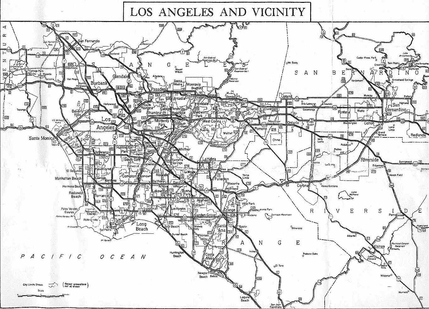
When the freeway reaches the East Los Angeles Interchange one mile (1.6 km) east of downtown Los Angeles, I-5 becomes the Golden State Freeway. The route continues through the San Fernando Valley and then crosses the Newhall Pass through the Santa Susana Mountains into the Santa Clarita Valley. From there, the Golden State Freeway sharply rises to the north to eventually cross the Tejon Pass through the Tehachapi Mountains with Path 26 power lines generally paralleling the freeway. The freeway then sharply descends for 12 miles (19 km) from over 4,100 feet (1,250 m) at Tejon Pass to around 1,600 feet (488 m) at Grapevine near the southernmost point of the San Joaquin Valley, approximately 30 miles (50 km) south of Bakersfield and 4 miles (6 km) south from where State Route 99 splits away from it in Wheeler Ridge.[9]
Central, Northern California


From Highway 99 to south of Tracy, I-5 parallels Highway 33, skirting along the far more remote western edge of the great Central Valley, and thus here is removed from population centers such as Bakersfield, Fresno, and Modesto with other state highways providing connections. For most of this section, the Path 15 electrical transmission corridor follows the highway, forming an infrastructure corridor along with the California Aqueduct.
Interstate 580 splits off from I-5 at a point south of Tracy, providing a loop-route connection to the San Francisco Bay Area. After passing Tracy, I-5 heads due north through Stockton and Sacramento before turning due west to Woodland. At Woodland, the interstate heads northwest again toward Dunnigan, where it converges with Interstate 505.
From Dunnigan, I-5 skirts north along the western edge of the Sacramento Valley, bypassing the larger cities of the region, including Yuba City, Oroville, and Chico, before reaching Red Bluff. I-5 then enters the Shasta Cascade region, passing through Redding and Shasta Lake before climbing up to near the foot of Mount Shasta. The interstate then travels to Weed and Yreka before reaching the Oregon border.
History
Historical naming in California
The portion of this highway from Los Angeles, to San Diego, was also co-signed as U.S. Route 101 until late 1964.
The portion of this highway from Lebec to Red Bluff roughly follows old US 99W.
In California, the former western branch of Interstate 5 (the northern end of the spur into the Bay Area) connecting Interstate 80 out of Vacaville to near Dunnigan, previously known as Interstate 5W, was renamed Interstate 505. Interstate 580 running between I-5 and I-80 was also once designated 5W; what is now I-5 (the stretch that runs through Sacramento) had been originally designated Interstate 5E.
Los Angeles Area
The Golden State Freeway was proposed by the California Highway Commission in 1953. The proposal drew strong criticism from East Los Angeles residents as it would dissect and eliminate large residential and commercial areas of Boyle Heights and Hollenbeck Heights.[10][11] The proposal also seemed to indicate a disregard for the ethnic Mexican American population of metropolitan Los Angeles. The "Boyle-Hollenbeck Anti-Golden State Freeway Committee" was formed for the purpose in blocking or re-routing the freeway. Then-Los Angeles City Council member Edward R. Roybal chaired that committee.[10] Despite this opposition, the construction of the freeway went ahead.
When this section was completed in 1956, the newspaper The Eastside Sun wrote the freeway led to the "eradication, obliteration, razing, moving, ripping asunder, demolishing of Eastside homes."[10][11]
Newhall Pass
In the evening of October 12, 2007, two trucks collided in the southbound tunnel that takes the truck bypass roadway under the main lanes near the Newhall Pass interchange. Fifteen trucks caught fire, killing three people and injuring 10.[12][13]
Sacramento Area
This article provides insufficient context for those unfamiliar with the subject. |
The section of I-5 running through downtown Sacramento is typically referred to by Caltrans as the "Boat Section" due to constant need for repair work and flooding issues.[14] Caltrans began working on the Boat Section during the 1960s and 1970s, draining the water from the area, creating a water pump system, building a retaining wall to protect the freeway from the Sacramento River. It was recently found that sand and silt from the Sacramento River were creating blockages in the drainage system that protected I-5.[14] Major work repair of the "Boat Section" in Sacramento began in May 30, 2008.[15] The construction was to take 40 days to complete and would require complete northbound and southbound closures on an alternating schedule. This section had major problems since being built, including being flooded in 15 feet (4.6 m) of water in 1980.
Exit list
- Note: Except where prefixed with a letter, postmiles were measured in 1964, based on the alignment as it existed at that time, and do not necessarily reflect current mileage. The numbers reset at county lines; the start and end postmiles in each county are given in the county column.
| County | Location | Postmile [1][16][17] |
#[18] | Destinations | Notes |
|---|---|---|---|---|---|
| San Diego SD R0.09-R72.37 |
San Diego | R0.09 | Mexico – United States border | ||
| R0.31 | 1A | Camino de la Plaza | No northbound exit | ||
| R0.88 | 1A | Northbound exit and southbound entrance | |||
| R1.20 | 1B | Via de San Ysidro | No southbound entrance | ||
| 2.31 | 2 | Dairy Mart Road | |||
| 3.10 | 3 | ||||
| 4.04 | 4 | Coronado Avenue | |||
| 4.63 | 5A | ||||
| 5.40 | 5B | Main Street | |||
| Chula Vista | 6.06 | 6 | Palomar Street | ||
| 6.81 | 7A | L Street | |||
| 7.30 | 7B | J Street | |||
| 7.81 | 8A | H Street | |||
| 8.56 | 8B | E Street (CR S17) | |||
| 9.40 | 9 | ||||
| National City | R10.04 | 10 | Mile of Cars Way, Bay Marina Drive | ||
| R10.75 | 11A | Harbor Drive, Civic Center Drive | |||
| R11.13 | 11B | Plaza Boulevard, 8th Street – Downtown National City | |||
| R11.66 | 12 | Division Street, Main Street, National City Boulevard | |||
| San Diego | R12.65 | 13A | |||
| R13.39 | 13B | 28th Street, National Avenue | |||
| R14.08 | 14A | ||||
| R14.12 | 14B | Cesar E. Chavez Parkway | |||
| R14.50 | 15A | Imperial Avenue | Southbound exit and northbound entrance | ||
| R14.74 | 15A | J Street | Northbound exit and southbound entrance | ||
| R15.04 | 15B | Northbound exit is via exit 15A | |||
| R15.32 | 15B | B Street – Civic Center | Signed as exit 15C southbound | ||
| R15.41 | 15B | Pershing Drive | Signed as exit 15C southbound | ||
| R16.07 | 16A | Signed as exit 16 southbound | |||
| R16.07 | 16 | 10th Avenue | Southbound exit and northbound entrance | ||
| R16.31 | 16B | 6th Avenue – Downtown San Diego | Northbound exit and southbound entrance | ||
| R16.59 | 17 | Front Street – Civic Center | No northbound exit | ||
| R16.91 | 17A | Hawthorn Street – San Diego Airport | No southbound exit | ||
| R17.53 | 18A | Pacific Highway | Northbound exit and southbound entrance | ||
| R17.77 | 17B | Sassafras Street – San Diego Airport | Signed as exit 18A southbound | ||
| R18.28 | 18B | Washington Street | |||
| R19.03 | 19 | Old Town Avenue | Serves Old Town San Diego State Historic Park | ||
| R19.98 | 20 | Rosecrans Street | Southbound exit and northbound entrance; former SR 209 south | ||
| R20.06 | 20 | No access from I-5 south to I-8 west | |||
| R20.82 | 21 | Sea World Drive, Tecolote Road | |||
| R22.26 | 22 | Clairemont Drive, East Mission Bay Drive | |||
| R22.87 | 23A | Grand Avenue, Garnet Avenue | Northbound exit and southbound entrance | ||
| R23.48 | 23B | Balboa Avenue east | Northbound exit is via exit 23; former SR 274 | ||
| R23.93 | 23 | Garnet Avenue | Southbound exit and northbound entrance | ||
| R25.95 | 26A | La Jolla Parkway | Northbound exit and southbound entrance | ||
| R25.95 | 26B | Signed as exit 26 southbound | |||
| R26.79 | 27 | Gilman Drive, La Jolla Colony Drive | |||
| R28.16 | 28A | Nobel Drive | Northbound exit and southbound entrance | ||
| R28.43 | 28B | La Jolla Village Drive | Signed as exit 28 southbound | ||
| R29.46 | 29 | Genesee Avenue (CR S21) | |||
| R30.43 | 30 | Sorrento Valley Road | Northbound exit and southbound entrance | ||
| R30.68 | 31 | Southbound left exit and northbound entrance | |||
| R31.80 | 32 | Carmel Mountain Road | Accessible only from Local Bypass | ||
| R32.90 | 33A | Northbound exit is accessible only from Local Bypass, southbound exit is via exit 33 | |||
| R32.90 | 33B | Carmel Valley Road | Signed as exit 33 southbound | ||
| R34.13 | 34 | Del Mar Heights Road | |||
| R36.27 | 36 | Via de la Valle (CR S6) | |||
| Solana Beach | R37.38 | 37 | Lomas Santa Fe Drive (CR S8) – Solana Beach | ||
| Encinitas | R38.62 | 39 | Manchester Avenue | ||
| R39.83 | 40 | Birmingham Drive | |||
| R40.60 | 41A | Santa Fe Drive – Encinitas | |||
| R41.51 | 41B | Encinitas Boulevard (CR S9) – Encinitas | |||
| R42.71 | 43 | Leucadia Boulevard | |||
| Carlsbad | R44.07 | 44 | La Costa Avenue | ||
| R45.57 | 45 | Poinsettia Lane, Aviara Parkway | |||
| R47.03 | 47 | Palomar Airport Road (CR S12), Carlsbad Boulevard | Serves McClellan-Palomar Airport | ||
| R47.98 | 48 | Cannon Road | |||
| R49.28 | 49 | Tamarack Avenue | |||
| R50.11 | 50 | Carlsbad Village Drive – Downtown Carlsbad | |||
| R50.68 | 51A | Las Flores Drive | |||
| Oceanside | R51.20 | 51B | Signed as exits 51B (SR 78) and 51C (Vista Way) northbound | ||
| R51.47 | 51C | Cassidy Street | No northbound exit | ||
| R52.30 | 52 | Oceanside Boulevard | |||
| R53.21 | 53 | Mission Avenue (SR 76 Bus.) – Downtown Oceanside | Serves Mission San Luis Rey | ||
| R53.93 | 54A | Signed as exits 54A (SR 76) and 54B (Coast Highway) southbound | |||
| R54.39 | 54B | Harbor Drive – Camp Pendleton, Oceanside | Signed as exits 54B (Camp Pendleton) and 54C (Harbor Drive) northbound | ||
| R62.08 | 62 | Las Pulgas Road | |||
| R71.38 | 71 | Basilone Road – San Onofre | |||
| R72.28 | 72 | Cristianitos Road (I-5 Bus. north) | |||
| Orange ORA 0.00-44.38 |
San Clemente | 1.00 | 73 | Avenida Magdalena, Avenida Calafia | |
| 1.63 | 74 | El Camino Real | |||
| 2.31 | 75 | Avenida Presidio – San Clemente | No southbound exit | ||
| 2.66 | 75 | Avenida Palizada – San Clemente | Southbound exit and northbound entrance | ||
| 3.39 | 76 | Avenida Pico | |||
| 4.08 | 77 | Avenida Vista Hermosa | |||
| Dana Point | 5.80 | 78 | Camino de Estrella | ||
| 6.78 | 79 | Pacific Coast Highway was former US 101 Alt. north | |||
| San Juan Capistrano | 8.80 | 81 | Camino Capistrano | ||
| 9.60 | 82 | ||||
| 10.91 | 83 | Junipero Serra Road | |||
| Mission Viejo | 12.49 | 85A | Northbound exit and southbound entrance | ||
| 12.94 | 85B | Avery Parkway | Signed as exit 85 southbound | ||
| 13.78 | 86 | Crown Valley Parkway | |||
| 15.22 | 88 | Oso Parkway | |||
| Laguna Hills | 16.53 | 89 | La Paz Road | ||
| 17.47 | 90 | Alicia Parkway | |||
| 18.69 | 91 | El Toro Road (CR S18) | |||
| 19.89 | 92A | Lake Forest Drive | Signed as exit 92 southbound | ||
| Irvine | 20.84 | 92B | Bake Parkway | Signed as exit 92 southbound | |
| 21.30 | 94A | Northbound exit and southbound entrance; former SR 7 north | |||
| 22.21 | 94B | Alton Parkway | Signed as exit 94 southbound | ||
| 22.80 | Barranca Parkway | Southbound exit and northbound entrance (HOV only) | |||
| 23.12 | 95 | Signed as exit 96B southbound | |||
| 23.12 | 95 | Southbound exit and northbound entrance | |||
| R23.94 | 96 | Sand Canyon Avenue | Signed as exit 96A southbound | ||
| R24.99 | 97 | Jeffrey Road | |||
| R26.58 | 99 | Culver Drive | |||
| 27.59 | 100 | Jamboree Road (to SR 261) | |||
| Tustin | |||||
| 28.25 | 101A | Tustin Ranch Road | |||
| R29.09 | 101B | Red Hill Avenue – Tustin | |||
| 29.62 | 102 | Newport Avenue | Southbound exit and northbound entrance | ||
| 30.26 | 103A | Northbound exit and southbound entrance | |||
| 30.26 | 103B | Signed as exit 103 southbound | |||
| Santa Ana | 30.90- 31.09 |
103C | First Street, Fourth Street | Signed as exit 104A southbound | |
| 31.76 | 104 | Grand Avenue, Santa Ana Boulevard | Signed as exit 104B southbound | ||
| 32.46 | 105A | 17th Street | |||
| 33.09 | 105B | Main Street, Broadway – Santa Ana | Main Street was SR 73 south; Broadway was former SR 51 north | ||
| Santa Ana, Orange |
34.00 | 106 | Signed as exit 107B southbound | ||
| 34.00 | 107A | Southbound exit and northbound entrance | |||
| 34.14 | 107A | La Veta Avenue, Bristol Street | Northbound exit is part of exit 106; serves Angel Stadium | ||
| 34.27 | 107A | Northbound exit and southbound entrance | |||
| Orange | 34.94 | 107B | Chapman Avenue | Southbound exit is via exit 107C; former SR 51 south | |
| 35.19 | 107C | State College Boulevard, The City Drive | State College Boulevard was former SR 250 north | ||
| 35.59 | 109A | Orangewood Avenue | Northbound exit is via exit 107C | ||
| Anaheim | |||||
| 35.92 | Gene Autry Way, Disney Way | HOV only | |||
| 36.26 | 109A | Katella Avenue | Signed as exit 109 northbound | ||
| 36.61 | 109B | Disney Way, Anaheim Boulevard | Northbound exit is via exit 109; former SR 72 | ||
| 37.40 | 110A | Harbor Boulevard | Signed as exit 110 northbound | ||
| 37.64- 38.06 |
110B | Disneyland Drive, Ball Road | Northbound exit is via exit 110 | ||
| 38.92 | 111 | Lincoln Avenue | Former SR 214 | ||
| 39.51 | 112 | Euclid Street | |||
| 40.71- 40.93 |
113 | Brookhurst Street, La Palma Avenue | Signed as exits 113A (Brookhurst Street, La Palma Avenue west) and 113B (La Palma Avenue east) northbound | ||
| Anaheim, Fullerton |
41.50 | 114 | Magnolia Avenue | Signed as exit 114A southbound | |
| 42.10 | 113C | Northbound exit and southbound entrance | |||
| 42.10 | 114B | Northbound exit is via exit 114 | |||
| Buena Park | 43.13 | 115 | Auto Center Drive | Northbound exit and entrance (currently under construction); former US 101 / SR 14 | |
| 43.43 | 116 | Currently under construction | |||
| 44.26 | 117 | Knott Avenue, Artesia Boulevard | Former SR 91 | ||
| Los Angeles LA 0.00-R88.61 |
La Mirada | 1.21 | 118 | Valley View Avenue – La Mirada | |
| Santa Fe Springs | |||||
| 1.68 | Alondra Boulevard | No exit ramps | |||
| Santa Fe Springs, Norwalk |
2.41 | 119 | Carmenita Road | ||
| 3.44 | 120A | Rosecrans Avenue – La Mirada | Signed as exit 120 southbound | ||
| Norwalk | 3.64 | 120B | Firestone Boulevard | Northbound left exit and southbound entrance; former SR 42 | |
| 4.41 | 121 | Norwalk Boulevard, San Antonio Drive – Norwalk | Former SR 35 | ||
| 4.91- 5.12 |
122 | Imperial Highway, Pioneer Boulevard | |||
| Santa Fe Springs, Downey |
6.38 | 123 | Florence Avenue | ||
| 6.85 | 124 | ||||
| Downey | 8.31 | 125 | |||
| 8.95 | 126A | Paramount Boulevard – Downey | |||
| Montebello, Commerce |
9.70 | 126B | Slauson Avenue – Montebello | No northbound entrance | |
| 10.88 | 128A | Bandini Boulevard, Garfield Avenue | |||
| Commerce | 11.55 | 128B | Washington Boulevard – Commerce | ||
| 12.80 | 129 | Eastern Avenue, Atlantic Boulevard | Former SR 15 | ||
| 12.92 | 130A | Atlantic Boulevard south, Triggs Street | |||
| 13.78 | 130C | Northbound exit and southbound entrance | |||
| 13.78 | 130B | Northbound exit is via exit 130A | |||
| 13.89 | 130B | Eastern Avenue | Northbound exit only | ||
| 14.25 | 131A | Olympic Boulevard | Southbound exit and northbound entrance; former SR 26 / SR 245 | ||
| 14.80 | 131B | Ditman Avenue | Southbound exit and entrance only | ||
| Los Angeles | 14.94 | 131 | Indiana Street | Signed as exit 132 southbound; former SR 165 | |
| 132 | Calzona Street | Northbound exit and entrance only | |||
| 16.05 | 133 | Grande Vista Avenue | Northbound exit and southbound entrance | ||
| 16.05 | 133 | Euclid Avenue | Southbound exit and northbound entrance | ||
| 16.59 | 134B | Soto Street | No exit number southbound | ||
| 16.05 | 133 | Grande Vista Avenue | Northbound exit and southbound entrance | ||
| 16.47 | 134B | Southbound left exit and northbound entrance | |||
| 16.59 | 134B | Soto Street | Signed as exit 134A southbound | ||
| 16.88 | Northbound left exit and southbound entrance | ||||
| 16.90 | 134C | Seventh Street | No southbound exit; left exit northbound | ||
| 16.90 | 134A | South end of I-10 overlap; no exit number southbound | |||
| 17.56 | 135A | Fourth Street | Former SR 60[19] | ||
| 18.06 | 135B | Cesar Chavez Avenue | |||
| 18.45 | 135C | North end of I-10 overlap; signed as exit 135B southbound | |||
| 18.78 | 135C | Mission Road | No northbound exit | ||
| 19.20 | 136A | Main Street | Signed as exit 136 southbound; no entrance ramps | ||
| 19.73 | 136B | Broadway | Southbound exit is part of exit 137A | ||
| 20.44 | 137B | Signed as exit 137A southbound | |||
| 137A | Figueroa Street | Southbound exit is part of exit 137B; former SR 159 / SR 163 north | |||
| 137B | Southbound exit and northbound entrance | ||||
| 21.94 | 138 | Stadium Way | |||
| 22.55 | 139 | Signed as exits 139A (north) and 139B (south) northbound | |||
| 22.97 | 140A | Fletcher Drive | Southbound exit and northbound entrance; former SR 2 | ||
| 23.66 | 140B | Glendale Boulevard | Signed as exit 140 northbound | ||
| 24.33 | 141A | Los Feliz Boulevard | Signed as exit 141 southbound | ||
| 24.60 | 141B | Griffith Park | Northbound exit and southbound entrance | ||
| 25.78 | 142 | Colorado Street | Former SR 134 east / SR 163 south | ||
| 26.47 | 144A | Zoo Drive | No southbound exit; serves Los Angeles Zoo | ||
| 26.65 | 144A | Signed as exit 144 southbound | |||
| 27.08 | 144B | Northbound exit and southbound entrance | |||
| Glendale | 27.84 | 145A | Western Avenue | ||
| Burbank | 28.43 | 145B | Alameda Avenue | Former SR 134 west | |
| 29.16 | 146A | Olive Avenue, Verdugo Avenue – Burbank | |||
| 29.78 | 146B | Burbank Boulevard | |||
| 30.47 | 147A | Scott Road – Burbank | Signed as exit 147 southbound; no southbound entrance | ||
| 30.75 | 147B | Lincoln Street | Northbound exit and southbound entrance | ||
| 31.23 | 148 | Buena Vista Street | |||
| Los Angeles | 32.35 | 149 | Hollywood Way | ||
| 33.28 | 150A | Glenoaks Boulevard | Northbound exit and southbound entrance | ||
| 33.68 | 150B | Sunland Boulevard – Sun Valley | Signed as exit 150 southbound | ||
| 34.28 | 151 | Penrose Street | No northbound entrance | ||
| 34.65- 34.99 |
152 | Lankershim Boulevard, Tuxford Street – North Hollywood | Former SR 170 | ||
| 35.94 | 153A | Sheldon Street | |||
| 36.36 | 153B | Southbound exit and northbound entrance | |||
| 36.86 | 153B | Branford Street | Northbound exit and southbound entrance | ||
| 37.41 | 154 | Osborne Street – Arleta | |||
| 37.96 | 155A | Terra Bella Street | Northbound exit and southbound entrance | ||
| 38.50 | 155B | Van Nuys Boulevard – Pacoima | Northbound exit and southbound entrance | ||
| 39.05 | 156A | Paxton Street | Signed as exit 156B northbound | ||
| 39.36 | 156B | Signed as exit 156A northbound; southbound exit to SR 118 west is via exit 156A | |||
| 39.98 | 157A | Brand Boulevard – San Fernando | Northbound exit and southbound entrance; former SR 118 | ||
| 40.24 | 157B | San Fernando Mission Boulevard – San Fernando | Signed as exit 157 southbound; former US 66 south / US 99 south | ||
| 41.60 | 158 | Southbound exit and northbound entrance; former SR 7 south | |||
| 42.65 | 159 | Roxford Street – Sylmar | Signed as exits 159A (east) and 159B (west) northbound | ||
| R44.01 | 161A | Signed as exit 161B northbound | |||
| R44.87 | 161B | Balboa Boulevard | Southbound exit and northbound entrance | ||
| R45.58 | 162 | Former US 6 north | |||
| Santa Clarita | R49.03 | 166 | Calgrove Boulevard | ||
| R50.33 | 167 | Lyons Avenue, Pico Canyon Road | |||
| R51.44 | 168 | McBean Parkway | |||
| R52.47 | 169 | Valencia Boulevard | |||
| R53.57 | 170 | Magic Mountain Parkway | Former SR 126 east | ||
| R54.17 | 171 | Rye Canyon Road | Southbound exit and entrance | ||
| R55.48 | 172 | ||||
| R56.60 | 173 | Hasley Canyon Road – Wayside Honor Rancho | |||
| R59.01 | 176A | Parker Road – Castaic | Northbound exit and southbound entrance | ||
| R59.49 | 176B | Lake Hughes Road – Castaic Lake Park, Castaic | Signed as exit 176 southbound | ||
| R65.97 | 183 | Templin Highway | |||
| R74.45 | 191 | Vista del Lago Road | |||
| R77.96 | 195 | Smokey Bear Road | |||
| R81.49- R82.10 |
198A | Signed as exit 199 southbound | |||
| R81.76 | 198B | Quail Lake Road | Signed as exit 198 southbound | ||
| Gorman | R85.80 | 202 | Gorman | ||
| R88.57 | 205 | Frazier Mountain Park Road | |||
| Kern KER R0.00-R15.86 |
Lebec | 1.61 | 207 | Lebec | |
| Fort Tejon | 5.02 | 210 | Fort Tejon | ||
| Grapevine | 10.15 | 215 | Grapevine | ||
| 13.52 | 219 | Laval Road | Signed as exits 219A (east) and 219B (west) | ||
| R15.86 | 221 | Northbound left exit and southbound entrance; former US 99 north | |||
| 19.61 | 225 | ||||
| 22.88 | 228 | Copus Road | |||
| 29.07 | 234 | Old River Road | |||
| 33.49 | 239 | ||||
| 38.79 | 244 | Former US 399 | |||
| 41.19 | 246 | ||||
| 47.55 | 253 | Stockdale Highway | |||
| 52.15 | 257 | ||||
| 56.64 | 262 | 7th Standard Road, Rowlee Road | Northbound exit and southbound entrance | ||
| 58.01 | 263 | Buttonwillow, McKittrick | Southbound exit and northbound entrance | ||
| 62.61 | 268 | Lerdo Highway – Shafter | |||
| Lost Hills | 73.02 | 278 | Former US 466 | ||
| 82.35 | 288 | Twisselman Road | |||
| Kings KIN 0.00-26.72 |
12.36 | 305 | Utica Avenue | ||
| 16.60 | 309 | ||||
| Fresno FRE 0.00-66.16 |
0.23 | 319 | |||
| 5.50 | 325 | Jayne Avenue – Coalinga | |||
| 14.87 | 334 | ||||
| 17.96 | 337 | South end of SR 33 overlap | |||
| 29.96 | 349 | North end of SR 33 overlap | |||
| 38.36 | 357 | Kamm Avenue | |||
| 45.80 | 365 | Manning Avenue – San Joaquin | |||
| 48.99 | 368 | Panoche Road | |||
| 52.75 | 372 | Russell Avenue – Dos Palos | |||
| 60.08 | 379 | Shields Avenue (CR J1) – Mendota | |||
| 65.78 | 385 | Nees Avenue – Firebaugh | |||
| Merced MER 0.00-32.48 |
6.28 | 391 | |||
| 17.58 | 403 | Signed as exits 403A (south/east) and 403B (north/west) | |||
| Santa Nella | 21.84 | 407 | |||
| 32.39 | 418 | ||||
| Stanislaus STA 0.00-28.06 |
5.51 | 423 | Newman (Stuhr Road, CR J18) | ||
| 10.72 | 428 | Crows Landing (Fink Road) | |||
| 15.86 | 434 | Diablo Grande Parkway, Sperry Avenue (CR J17) – Patterson | |||
| 22.99 | 441 | Howard Road (CR J16) – Westley | |||
| San Joaquin SJ 0.00-49.82 |
0.68 | 446 | Northbound left exit and southbound entrance | ||
| 3.44 | 449 | Signed as exits 449A (east) and 449B (west) | |||
| 6.47 | 452 | ||||
| 11.06 | 457 | Kasson Road (CR J4) | |||
| R11.80 | 458A | Southbound exit and northbound entrance; former US 50 west | |||
| R12.62 | 458B | Southbound exit and northbound entrance | |||
| Lathrop | R13.87 | 460 | Mossdale Road, Manthey Road | ||
| R14.83 | 461 | ||||
| R16.47 | 462 | Louise Avenue | |||
| R17.52 | 463 | Lathrop Road | |||
| R19.58 | 465 | Roth Road – Sharpe Depot | |||
| R20.95 | 467A | El Dorado Street | Northbound exit and southbound entrance; former US 50 east | ||
| R21.44 | 467B | Mathews Road | |||
| R22.51 | 468 | French Camp Road (CR J9) – French Camp | |||
| Stockton | R23.66 | 469 | Downing Avenue | ||
| 24.64 | 470 | Eighth Street | |||
| 25.34 | 471 | South end of SR 4 overlap | |||
| 26.19 | 472 | North end of SR 4 overlap | |||
| 26.99 | 473 | Pershing Avenue, Oak Street, Fremont Street | |||
| 27.91 | 474A | Monte Diablo Avenue | |||
| 28.53 | 474B | Country Club Boulevard, Alpine Avenue | |||
| 29.99 | 476 | March Lane | |||
| 31.45 | 477 | Benjamin Holt Drive | |||
| 32.66 | 478 | Hammer Lane | |||
| 35.30 | 481 | Eight Mile Road | |||
| 39.57 | 485 | ||||
| 41.66 | 487 | Turner Road | |||
| 44.71 | 490 | Peltier Road (CR J12) | |||
| 47.60 | 493 | Thornton Road – Thornton, Walnut Grove (Walnut Grove Road, CR J11) | |||
| Sacramento SAC 0.02-34.65 |
2.13 | 498 | Twin Cities Road (CR E13) – Walnut Grove, Galt | ||
| 8.49 | 504 | Hood Franklin Road – Hood, Franklin | |||
| Elk Grove | 10.83 | 506 | Elk Grove Boulevard (CR E12) | ||
| 12.04 | 508 | Laguna Boulevard | |||
| Sacramento | 16.15 | 512 | |||
| 17.19 | 513 | Florin Road | |||
| 18.65 | 514 | 43rd Avenue | Southbound exit and northbound entrance | ||
| 19.30 | 515 | Fruitridge Road, Seamas Avenue | |||
| 20.53 | 516 | Sutterville Road | |||
| 22.25 | 518 | Broadway, X Street | |||
| 22.57 | 518 | Former I-80 | |||
| 23.18 | 519A | Q Street | |||
| 23.80 | 519B | J Street – Downtown Sacramento | |||
| 24.65 | 520 | Richards Boulevard | |||
| 25.34 | 521A | Garden Highway | Signed as exit 521 southbound | ||
| 25.97 | 521B | West El Camino Avenue | Northbound exit and southbound entrance | ||
| 26.72 | 522 | Former I-880 | |||
| 28.04 | 524 | Arena Boulevard | Serves ARCO Arena | ||
| 29.02 | 525A | Del Paso Road | Serves ARCO Arena | ||
| 29.91 | 525B | ||||
| 32.73 | 528 | Sacramento International Airport | |||
| Yolo YOL 0.00-R28.92 |
0.52 | 531 | Road 22 – Elkhorn | Former SR 16 | |
| Woodland | 5.53 | 536 | |||
| R6.51 | 537 | Northbound exit and southbound entrance; former SR 16 | |||
| R7.09 | 537 | South end of SR 113 overlap; southbound exit and northbound entrance | |||
| R8.26 | 538 | North end of SR 113 overlap | |||
| R9.41 | 540 | West Street | |||
| R10.81 | 541 | ||||
| R12.34 | 542 | Yolo (Road 17) | |||
| R17.62 | 548 | Zamora (Road 13, CR E10) | |||
| R22.61 | 552 | Southbound exit and northbound entrance | |||
| R23.79 | 554 | Road 8 | |||
| R25.57 | 556 | Dunnigan (Road 6, CR E4) | |||
| R28.92 | 559 | County Line Road | |||
| Colusa COL R0.00-R34.37 | |||||
| R6.79- R6.83 |
566 | Arbuckle, College City (I-5 Bus. north) | No northbound entrance | ||
| R7.70 | 567 | Frontage Road – Arbuckle (I-5 Bus. south) | |||
| R10.31 | 569 | Hahn Road | |||
| Williams | R15.91 | 575 | Husted Road (I-5 Bus. north) | ||
| R17.98 | 577 | Williams (SR 20 Bus.) | |||
| R18.72 | 578 | ||||
| R26.73 | 586 | Maxwell Road | |||
| R29.25 | 588 | Maxwell (I-5 Bus. south) | Southbound exit and northbound entrance | ||
| R31.84 | 591 | Delevan Road | |||
| Glenn GLE R0.00-R28.82 |
R1.52 | 595 | Road 68 | ||
| R7.61 | 601 | Road 57 (I-5 Bus. north) | |||
| Willows | R9.87 | 603 | |||
| R13.90 | 607 | Road 39 – Bayliss | |||
| R16.80 | 610 | Artois (Road 33) | |||
| R20.82 | 614 | Road 27 | |||
| Orland | R24.82 | 618 | South Street, Road 16 | ||
| R25.53 | 619 | ||||
| R27.81 | 621 | Road 7 (I-5 Bus. south) | |||
| Tehama TEH R0.00-42.12 |
R5.77 | 628 | Liberal Avenue, Road 99W | ||
| Corning | R7.49 | 630 | South Avenue | ||
| R8.98 | 631 | Corning Road (CR A9) – Corning | |||
| R10.97 | 633 | Finnell Avenue – Richfield | |||
| R13.97 | 636 | Gyle Road – Tehama, Los Molinos | |||
| R19.78 | 642 | Flores Avenue – Proberta, Gerber | |||
| Red Bluff | R24.87 | 647 | South Main Street (I-5 Bus. north) – Red Bluff | Signed as exit 647A southbound | |
| R24.94 | 647B | Diamond Avenue | Southbound exit and northbound entrance | ||
| R26.53 | 649 | ||||
| R27.47 | 650 | Adobe Road | |||
| R28.38 | 651 | Red Bluff (Main Street, I-5 Bus. south) | Southbound exit and northbound entrance; connects to SR 36 west | ||
| 31.04 | 652 | Wilcox Golf Road | |||
| 32.24 | 653 | Jellys Ferry Road | |||
| 36.37 | 657 | Auction Yard Road, Hooker Creek Road | |||
| 38.72 | 659 | Sunset Hills Drive, Auction Yard Road | |||
| 41.53 | 662 | Bowman Road (CR A5, CR A17) – Cottonwood | |||
| Shasta SHA 0.00-67.02 |
0.91 | 664 | Gas Point Road – Balls Ferry | ||
| 1.91 | 665 | Cottonwood | Southbound exit and northbound entrance | ||
| Anderson | R3.83- R4.29 |
667 | Deschutes Road, Factory Outlets Drive – Anderson (SR 273 north) | ||
| R5.29- R5.64 |
668 | Central Anderson, Lassen National Park (North Street) | |||
| R6.74 | 670 | Riverside Avenue | |||
| R9.77 | 673 | Knighton Road – Redding Airport | |||
| Redding | R12.15 | 675 | Bechelli Lane, Churn Creek Road | ||
| R14.46 | 677 | Cypress Avenue – Redding | |||
| R15.45 | 678 | Signed as exits 678A (east) and 678B (west) southbound | |||
| R17.32 | 680 | ||||
| R18.07 | 681A | Twin View Boulevard | Signed as exit 681 northbound | ||
| R18.48 | 681B | Southbound exit and northbound entrance | |||
| R19.40 | 682 | Oasis Road | |||
| Shasta Lake | R21.00 | 684 | Pine Grove Avenue | ||
| R22.14 | 685 | ||||
| R24.08 | 687 | Wonderland Boulevard – Mountain Gate | |||
| R26.04 | 689 | Fawndale Road, Wonderland Boulevard | |||
| R27.63 | 690 | Bridge Bay Road | |||
| R29.32 | 692 | Turntable Bay Road | |||
| R30.23 | 693 | Packers Bay Road | Southbound exit and entrance | ||
| R32.16 | 695 | Shasta Caverns Road – O'Brien | |||
| R36.83 | 698 | Gilman Road, Salt Creek Road | |||
| R41.05 | 702 | Lakeshore Drive, Antlers Road | |||
| R42.32 | 704 | Riverview Drive – Lakehead | |||
| R45.95 | 707 | Vollmers | |||
| R49.15 | 710 | La Moine | |||
| R50.81 | 712 | Pollard Flat | |||
| 52.90 | 714 | Gibson Road | |||
| 57.41 | 718 | Sims Road | |||
| 59.35 | 720 | Flume Creek Road | |||
| 60.51 | 721 | Conant Road | |||
| 61.75 | 723 | Sweetbrier Avenue | |||
| 63.58 | 724 | Castella | |||
| 65.41 | 726 | Soda Creek Road | |||
| 66.00 | 727 | Crag View Drive | Northbound exit only | ||
| 66.84 | 728 | Railroad Park Road, Crag View Drive | |||
| Siskiyou SIS 0.00-R69.29 |
0.69 | 729 | Dunsmuir (I-5 Bus. north) | ||
| Dunsmuir | 2.51 | 730 | Central Dunsmuir | ||
| 3.84 | 732 | Dunsmuir Avenue (I-5 Bus. south), Siskiyou Avenue | |||
| 5.90 | 734 | Mott Road | |||
| R8.49 | 736 | ||||
| R8.79 | 737 | Mount Shasta (I-5 Bus. north) | Northbound exit and southbound entrance | ||
| Mount Shasta | R10.49 | 738 | Central Mount Shasta | ||
| R12.06 | 740 | Mount Shasta (I-5 Bus. south) | Southbound exit and northbound entrance | ||
| R13.18 | 741 | Abrams Lake Road | |||
| R15.34 | 743 | Summit Drive, Truck Village Drive | |||
| Weed | R17.44 | 745 | South Weed Boulevard (I-5 Bus. north) – South Weed | ||
| R19.07 | 747 | ||||
| R19.86 | 748 | ||||
| R23.00 | 751 | Stewart Springs Road (I-5 Bus. north) – Edgewood, Gazelle | |||
| R25.35 | 753 | Weed Airport Road | Serves Weed Airport | ||
| R31.18 | 759 | Louie Road | |||
| R38.21 | 766 | Montague, Grenada, Gazelle (CR A12, I-5 Bus. south) | |||
| R42.51 | 770 | Easy Street, Shamrock Road | |||
| Yreka | R45.62 | 773 | |||
| R47.56 | 775 | Central Yreka | |||
| R48.24 | 776 | Montague, Yreka (SR 3) | |||
| R58.33 | 786 | ||||
| R61.55 | 789 | Henley, Hornbrook (CR A28) | |||
| R62.92 | 790 | Hornbrook Highway, Ditch Creek Road | |||
| R65.52 | 793 | Bailey Hill Road | |||
| R68.33 | 796 | Hilt | |||
| R69.29 | Oregon state line | ||||
References
- ^ a b California Department of Transportation, State Truck Route List (XLS file), accessed February 2008
- ^ California Highways: Interstate Highway Types and the History of California's Interstates
- ^ California Highways: Interstate 10
- ^ CA Codes (shc:250-257)
- ^ CA Codes (shc:260-284)
- ^ a b c San Diego County Road Atlas (Map). Thomas Brothers. 2009.
- ^ The Road Atlas (Map). Rand McNally. 2007. p. 30.
- ^ Orange County Road Atlas (Map). Thomas Brothers. 2009.
- ^ Los Angeles County Road Atlas (Map). Thomas Brothers. 2009.
- ^ a b c Chavez, Ernesto (2002). "Mi raza primero!" (My people first!). University of California Press. pp. 25–26. ISBN 0520230183.
- ^ a b Avila, Erik (2006). Popular Culture in the Age of White Flight. University of California Press. pp. 208–212. ISBN 0520248112.
- ^ cbs2.com - I-5 Closure May Last Until Tuesday
- ^ Investigators advance into tunnel after deadly inferno - CNN.com
- ^ a b "Boat Section History". Fix I-5 Project. Retrieved 2008-12-29.
- ^ "What's Happening?". Fix I-5. Retrieved 2008-12-29.
- ^ California Department of Transportation, Log of Bridges on State Highways, July 2007
- ^ California Department of Transportation, All Traffic Volumes on CSHS, 2005 and 2006
- ^ California Department of Transportation, California Numbered Exit Uniform System, I-5, accessed February 2008
- ^ Division of Highways, Los Angeles and Vicinity, 1963: shows that Legislative Route 172, which became SR 60 in 1964, was on Fourth Street
External links
- History of the Northern Los Angeles County section of Interstate 5 (Photos, text, TV shows)
| ||
- Interstate Highways in California
- Interstate 5
- Juan Bautista de Anza National Historic Trail
- Southern California freeways
- Central Valley of California
- Roads in San Diego County, California
- Roads in Orange County, California
- Roads in Los Angeles County, California
- Roads in Kern County, California
- Roads in Kings County, California
- Roads in Fresno County, California
- Roads in Merced County, California
- Roads in Stanislaus County, California
- Roads in San Joaquin County, California
- Roads in Sacramento County, California
- Roads in Yolo County, California
- Roads in Colusa County, California
- Roads in Glenn County, California
- Roads in Tehama County, California
- Roads in Shasta County, California
- Roads in Siskiyou County, California
- Scenic highways in California
- U.S. Route 99