From Wikipedia, the free encyclopedia
Mountain range in Alberta, Canada
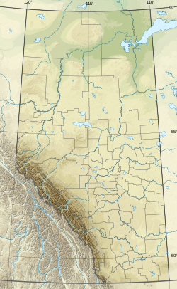
The Spray Mountains is a mountain range of the Canadian Rockies located in southwestern Alberta, Canada.
This range includes the following mountains and peaks:[5]
| Mountain / Peak |
Elevation |
Prominence |
FA |
Coordinates
|
| m |
ft |
m |
ft
|
| Mount Sir Douglas
|
3,406
|
11,175
|
1,110
|
3,640
|
1919
|
50°43′21″N 115°20′20″W / 50.72250°N 115.33889°W / 50.72250; -115.33889
|
| Mount French
|
3,244
|
10,643
|
470
|
1,540
|
1921
|
50°43′45″N 115°18′20″W / 50.72917°N 115.30556°W / 50.72917; -115.30556
|
| Mount Robertson
|
3,177
|
10,423
|
281
|
922
|
1928
|
50°43′34″N 115°19′16″W / 50.72611°N 115.32111°W / 50.72611; -115.32111
|
| Mount Smith-Dorrien
|
3,155
|
10,351
|
225
|
738
|
1933
|
50°43′55″N 115°17′25″W / 50.73194°N 115.29028°W / 50.73194; -115.29028
|
| Mount Birdwood
|
3,097
|
10,161
|
735
|
2,411
|
1922
|
50°47′7″N 115°22′5″W / 50.78528°N 115.36806°W / 50.78528; -115.36806
|
| Mount Jellicoe
|
3,075
|
10,089
|
179
|
587
|
1922
|
50°42′52″N 115°17′20″W / 50.71444°N 115.28889°W / 50.71444; -115.28889
|
| Mount Maude
|
3,043
|
9,984
|
330
|
1,080
|
Unk
|
50°42′2.9″N 115°18′10.8″W / 50.700806°N 115.303000°W / 50.700806; -115.303000
|
| Mount Murray
|
3,026
|
9,928
|
313
|
1,027
|
Unk
|
50°44′57″N 115°17′35″W / 50.74917°N 115.29306°W / 50.74917; -115.29306
|
| Mount Black Prince
|
2,939
|
9,642
|
239
|
784
|
1956
|
50°41′43″N 115°14′41″W / 50.69528°N 115.24472°W / 50.69528; -115.24472
|
| Mount Smuts
|
2,938
|
9,639
|
591
|
1,939
|
Unk
|
50°48′28″N 115°23′13″W / 50.80778°N 115.38694°W / 50.80778; -115.38694
|
| Mount Warspite
|
2,850
|
9,350
|
240
|
790
|
Unk
|
50°40′52″N 115°12′59″W / 50.68111°N 115.21639°W / 50.68111; -115.21639
|
| Pigs Tail[6]
|
2,822
|
9,259
|
|
|
|
|
| Snow Peak
|
2,789
|
9,150
|
312
|
1,024
|
Unk
|
50°46′21″N 115°23′9″W / 50.77250°N 115.38583°W / 50.77250; -115.38583
|
| Mount Shark
|
2,786
|
9,140
|
134
|
440
|
Unk
|
50°49′41″N 115°24′36″W / 50.82806°N 115.41000°W / 50.82806; -115.41000
|
| Cegnfs[7]
|
2,785
|
9,137
|
|
|
|
|
| Commonwealth Peak
|
2,775
|
9,104
|
215
|
705
|
1970
|
50°47′25″N 115°20′55″W / 50.79028°N 115.34861°W / 50.79028; -115.34861
|
| Mount Burstall
|
2,760
|
9,060
|
245
|
804
|
1972
|
50°46′10″N 115°19′31″W / 50.76944°N 115.32528°W / 50.76944; -115.32528
|
| Mount Invincible
|
2,700
|
8,900
|
140
|
460
|
1957
|
50°39′50″N 115°11′27″W / 50.66389°N 115.19083°W / 50.66389; -115.19083
|
| Mount Indefatigable
|
2,670
|
8,760
|
198
|
650
|
1901
|
50°39′12″N 115°10′19″W / 50.65333°N 115.17194°W / 50.65333; -115.17194
|
| Mount Nomad
|
2,544
|
8,346
|
185
|
607
|
Unk
|
50°39′48″N 115°12′38″W / 50.66333°N 115.21056°W / 50.66333; -115.21056
|
|
|---|
| Ranges | |
|---|
| Mountains | |
|---|
| Passes | |
|---|
| Glaciers | |
|---|
| Rivers | |
|---|
| Peoples | |
|---|
Parks and
protected areas | | International | |
|---|
| National | |
|---|
| Provincial (AB) | |
|---|
| Provincial (BC) | |
|---|
|
|---|
| Ski resorts | |
|---|
| Communities | |
|---|
Ecozone and
ecoregions | |
|---|
|


