Chitvel
Appearance


| Nickname: Chitvelu | |
 Dynamic map | |
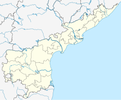
Location in Andhra Pradesh, India | |
| Coordinates: 14°10′00″N 79°20′00″E / 14.1667°N 79.3333°E | |
| Country | |
| State | Andhra Pradesh |
| District | Annamayya |
| Elevation | 132 m (433 ft) |
| Languages | |
| • Official | Telugu,Urdu |
| Time zone | UTC+5:30 (IST) |
| PIN | 516104 |
| Telephone code | 08566 |
| Vehicle registration | AP-04 ,AP-39 |
Chitvel is a small town in Annamayya district of the Indian state of Andhra Pradesh. It is located in Chitvel mandal of Rajampet in the Rayalaseema Region. chitvel has India's longest electrified railway tunnel between Chitvel and Rapur, 6.6 km long. This line connects Obulavaripalli-Krishnapatnam port and opened by vice president M. Venkaiah Naidu on Aug 21, 2019.This is the main railway line in this area.[1]
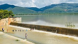
Sights and attractions around chitvel is Gundalakona, a regionally famous Lord Shiva temple and Guttamaneru Dam

Geography
[edit]
Chitvel is located at 14°10′00″N 79°20′00″E / 14.1667°N 79.3333°E.[2] It has an average elevation of 132 meters (436 feet).
Notable people
[edit]1.Penchal Das singer, songwriter, and poet in the telugu film industry
References
[edit]- ^ "Revenue Divisions and Mandals". Official website of YSR Kadapa District. National Informatics Centre- Kadapa, Andhra Pradesh. Archived from the original on 6 July 2015. Retrieved 23 May 2015.
- ^ Falling Rain Genomics.Chitvel

