Danhah
Danhah
ضَنْحَه (Arabic) Ḍanḥah | |
|---|---|
 Danhah – Palm groves and old drystone buildings | |
| Coordinates: 25°34′45″N 56°11′06″E / 25.57917°N 56.18500°E | |
| Country | |
| Emirate | |
| Area | |
• Total | 0.42 km2 (0.16 sq mi) |
| Elevation | 170 m (558 ft) |
| Time zone | UTC+04:00 |
Danhah (Arabic: ضَنْحَه, romanized: Ḍanḥah) [1] is a small agricultural and livestock village in the Emirate of Fujairah, northeastern U.A.E.
Geography and history
[edit]The village has many small scattered farms, cultivated fields, and lush palm groves,[2] although it has been greatly affected by the activity of large, now abandoned, quarries. In the vicinity of the current town are the ruins of the old village, which is practically destroyed.[3]
Danhah is located on the banks of the Wadi Danhah, a tributary of the Wadi Al Fay.
The Wadi Danhah, in its middle course, forms a deep and spectacular gorge where erosion caused by water flow has exposed multicolored layers of highly polished, extremely hard, stratified sedimentary rocks, predominantly in reddish, ochre, and white tones.
This picturesque landscape has allowed Danhah to become a popular tourist and hiking destination in recent years, attracting numerous visitors. [4][5]
Some of the former inhabitants of the Danhah area moved their permanent homes to the surroundings of the village of Ghub,[1] which has expanded west of the central area of the floodplain of Dibba (Arabic: سَيْح دِبَّا, romanized: Sayḥ Dibbā).[6]
-
Wadi Danhah - Wadi Zanhah - Gorge and stratified rocks
-
Palm groves and cultivated areas
-
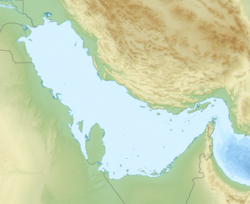
Map of Wadi Danhah - Wadi Zanhah - Emirate of Fujairah
Toponymy
[edit]Alternative names: Dhanhah, Z̧anḩah, Zahar, Z̧aḩah, Zanhah, Ḍanḥah, Danhah, Dhanha.
The name Danhah (spelled Dhanha and Z̧anḩah), its wadis, mountains, and nearby towns, were recorded in the documentation and maps produced between 1950 and 1960 by the British Arabist, cartographer, military officer and diplomat Julian F. Walker, during the work carried out to establish the borders between the then so-called Trucial States,[7] later completed by the UK Ministry of Defence, with 1:100,000 scale maps published from 1971 onwards.[6]
The National Atlas of the United Arab Emirates does not expressly mention the name of this village, but Wadi Danhah does, spelled Wādī Ḍanḥah.[1]
Population
[edit]The area near the Danhah and Wadi Danhah was mainly populated by the Sharqiyin tribe, specifically the tribal sections or areas of Dhanahana,[2] Yamāmaḩah, and Fuhūd.[8][9][10]
Near Danhah / Zanhah, there are archaeological remains that testify to human presence in this area since very ancient times.[3]
See also
[edit]References
[edit]- ^ a b c Jāmiʿat al-Imārāt al-ʿArabīyah al-Muttaḥidah (1993). The national atlas of the United Arab Emirates. Al Ain, United Arab Emirates: United Arab Emirates University with GEOprojects (U.K.) Ltd. ISBN 9780863511004.
- ^ a b Emirates Wildlife Encyclopedia - Prepared and Researched - Juma Khalifa bin Thalith Al-Himyari - Knowledge and Human Development Authority Dubai, United Arab Emirates (2014) - pg. 271 - موسوعة الإمارات البرية - إعداد وبحث - جمعة خليفة بن ثالث الحميري - هيئة المعرفة والتنمية البشرية دبي، الإمارات العربية المتحدة <https://khda.gov.ae/CMS/WebParts/TextEditor/Documents/Heritage_Book_2014.pdf>
- ^ a b Britton, Georgia. “An Archaeological Survey of Northern Fujairah, United Arab Emirates.” Arabian Archaeology and Epigraphy, pg. 159 - 2004. <:https://www.academia.edu/48243045/An_archaeological_survey_of_northern_Fujairah_United_Arab_Emirates>
- ^ "Wadi Zanhah - Rainbow Valley Hike - Vishak Bhat". www.wikiloc.com - Trails of the World. Retrieved 2025-05-06.
- ^ "Fujairah Adventure Guide - Dhanha Trail". Fujairah Adventure Guide. Retrieved 2025-05-06.
- ^ a b Map FCO 18/1787 - 1972 - Oman and the United Arab Emirates (UAE): Dibba, with handwritten annotations - Scale 1:100,000 - Published by D Survey, Ministry of Defence, United Kingdom (1971) - Edition 3-GSGS - The National Archives, London, England <https://www.agda.ae/en/catalogue/tna/fco/18/1787>
- ^ FCO 18/1969 - 1959 - Sketch map drawn by Julian Walker for boundary delimitation: Dibba - The National Archives, London, England <https://www.agda.ae/en/catalogue/tna/fco/18/1969>
- ^ Lancaster, William, 1938- (2011). Honour is in contentment : life before oil in Ras al-Khaimah (UAE) and some neighboring regions. Lancaster, Fidelity. Berlin: De Gruyter. ISBN 978-3-11-022340-8. OCLC 763160662.
{{cite book}}: CS1 maint: multiple names: authors list (link) CS1 maint: numeric names: authors list (link) - ^ Gazetteer of the Persian Gulf. Vol. II. Geographical and Statistical. J G Lorimer. 1908', British Library: India Office Records and Private Papers, IOR/L/PS/20/C91/4, in Qatar Digital Library <https://www.qdl.qa/en/archive/81055/vdc_100023515720.0x00005d>
- ^ Tribes of Trucial States coast - 1958- Ref. FO 371/132894 <https://www.agda.ae/index.php/en/catalogue/tna/fo/371/132894/n/96>
External links
[edit]![]() Media related to Danhah at Wikimedia Commons
Media related to Danhah at Wikimedia Commons


