Ireres
Appearance
This article needs additional citations for verification. (May 2025) |
Ireres | |
|---|---|
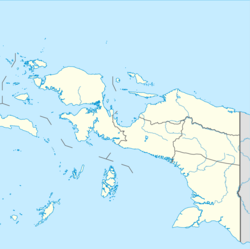
| Coordinates: 0°51′19.4465″S 132°18′7.7702″E / 0.855401806°S 132.302158389°E | |
| Country | Indonesia |
| Province | Southwest Papua |
| Regency | Tambrauw |
| District seat | Miri |
| Area | |
• Total | 431.50 km2 (166.60 sq mi) |
| Population (mid 2023
Estimate) | |
• Total | 851 |
| • Density | 2.0/km2 (5.1/sq mi) |
| Time zone | UTC+9 (WIT) |
| Postal Code | 98367 |
| Villages | 6 |
Ireres is a district in Tambrauw Regency, Southwest Papua Province, Indonesia.[1][2]
Geography
[edit]Miyah consists of six villages, namely:
- Aifamas
- Atafrumek
- Ifiam
- Meinad
- Meis
- Miri
References
[edit]- ^ Kementerian Dalam Negeri Indonesia (2018-12-29). Permendagri No. 137 Tahun 2017.
- ^ BPS, Tambrauw, 2023-09-26, "Distrik Ireres Dalam Angka 2023". (Catalogue: 1102001.9109022).tambrauwkab.bps.go.id

