
Layyah District
Layyah District
ضلع لیّہ | |
|---|---|
| Layyah | |
  | |
 Map of Layyah District (highlighted in red) | |
| Country | |
| Province | |
| Division | Dera Ghazi Khan |
| Headquarters | Layyah |
| Government | |
| • Type | District Administration |
| • Deputy Commissioner | Ameera Baidar |
| • District Health Officer | N/A |
| • District Naib Nazim نائب ناظم | N/A |
| Area | |
| 6,289 km2 (2,428 sq mi) | |
| Population | |
| 2,102,386 | |
| • Density | 330/km2 (870/sq mi) |
| • Urban | 386,282 |
| • Rural | 1,716,104 |
| Literacy | |
| • Literacy rate |
|
| Time zone | UTC+5 (PST) |
| Area code | 0606 |
| Number of Tehsils | 3 |
| Website | layyah |
Layyah District (Saraiki: ضلع ليّہ, Urdu: ضلع ليہ), is a district in the Punjab, Pakistan. It is located in the southern part of the province. The city of Layyah is the administrative headquarters of Layyah district. Layyah has a hot, semi-arid climate.[3][4]
Geography
[edit]It lies between 30–45 to 31–24 degree north latitudes and 70–44 to 71–50 degree east longitudes. The area consists of a semi-rectangular block of sandy land between the Indus River and the Chenab River in Sindh Sagar Doab. The total area covered by the district is 6,291 km2, with a width from east to west of 88 kilometres (55 mi) and a length from north to south of 72 kilometres (45 mi).
History
[edit]This administrative status of Layyah was short-lived and the British reduced it to the level of Tehsil headquarters, making it a part of Dera Ismail Khan. In 1901, Layyah was transferred to the new District of Mianwali. Later on, it was made part of the Muzaffargarh District. In 1982, Layyah Tehsil was upgraded to District headquarters comprising three Tehsils: Layyah, Karor and Chaubara. The municipality was created in 1875.[3]
Administrative divisions
[edit]The district of Layyah is made up of three tehsils:[5][6]
| Tehsil[7] | Area
(km²)[8] |
Pop.
(2023) |
Density
(ppl/km²) (2023) |
Literacy rate
(2023)[2] |
Union Councils |
|---|---|---|---|---|---|
| Karor Lal Esan[3] | 1,823 | 684,729 | 375.61 | 62.43% | |
| Chaubara[3] | 2,754 | 299,082 | 108.60 | 58.42% | |
| Layyah | 1,712 | 1,118,575 | 653.37 | 62.34% |
Villages
[edit]Education
[edit]According to Pakistan District Education Ranking, a report released by Alif Ailaan, Layyah is ranked at number 38 out of 155 districts nationally with an education score of 66.76. The learning score of Layyah is 70.8.[9] The readiness score of Layyah is 65.13, ranking the district at number 31. Furthermore, the school infrastructure score of Layyah is 94.38, placing it a national rank of 18.[9] The score reflects that most schools in Layyah have all basic facilities e.g. electricity, drinking water and functional toilets.
The issues reported in TaleemDo! App by the residents of Layyah suggest that students of government schools have low confidence as compared to private schools, but the students are unable to attend private schools because of high fees. Complaints about quality of teachers and a few basic facilities are also the issues reported in the app.
Higher Education
[edit]Public Sector Colleges
[edit]There are 20 colleges available for the education of males and females of Layyah.[10]
- Boys 06
- Girls 09
- Commerce 05
- Total 20
Private Sector Colleges
[edit]- Boys 08
- Girls 03
- Commerce & Business 03
- Total 14
Public Sector Universities
[edit]- University of Layyah
Departments
[edit]- Department of Business Administration
- Department of English
- Department of Economics
- Department of Psychology
- Department of Sociology
- Department of Education
- Department of Information Technology
- Department of Computer Science
Colleges
[edit]- College of Veterinary Sciences
- College of Agriculture
Private Sector Universities
[edit]- Govt. College University Faisalabad (Layyah Campus)
- University of Education, Lahore (Layyah Campus)
- Govt. College University, Lahore (Layyah Campus)
- National College of Business Administration & Economics Lahore (Layyah Campus)
Floods
[edit]Sehar village residents of flood-prone Layyah district, had seen their homes repeatedly inundated and they finally took matters into their own hands and rebuilt their homes on raised dirt platforms five to six feet high, shored up with eucalyptus trees planted around the edges.[11][12][13]
Demography
[edit]| Year | Pop. | ±% p.a. |
|---|---|---|
| 1951 | 162,202 | — |
| 1961 | 273,224 | +5.35% |
| 1972 | 495,537 | +5.56% |
| 1981 | 666,517 | +3.35% |
| 1998 | 1,120,951 | +3.11% |
| 2017 | 1,823,995 | +2.60% |
| 2023 | 2,102,386 | +2.40% |
| Sources:[14] | ||
As of the 2023 census, Layyah district has 341,131 households and a population of 2,102,386. The district has a sex ratio of 106.23 males to 100 females and a literacy rate of 61.83%: 70.91% for males and 52.21% for females.[1][2] 604,722 (28.76% of the surveyed population) are under 10 years of age.[15] 386,282 (18.37%) live in urban areas.[1]
| Religious group |
1941[17]: 62–63 | 2017[18] | 2023[16] | |||
|---|---|---|---|---|---|---|
| Pop. | % | Pop. | % | Pop. | % | |
| Islam |
138,201 | 85.8% | 1,812,173 | 99.35% | 2,086,076 | 99.23% |
| Hinduism |
21,882 | 13.59% | 553 | 0.03% | 242 | 0.01% |
| Sikhism |
882 | 0.55% | — | — | 27 | 0% |
| Christianity |
4 | 0% | 9,673 | 0.53% | 14,427 | 0.69% |
| Ahmadi | — | — | 1,481 | 0.08% | 1,393 | 0.07% |
| Others [b] | 101 | 0.06% | 115 | 0.01% | 186 | 0.01% |
| Total Population | 161,070 | 100% | 1,823,995 | 100% | 2,102,361 | 100% |
| Note: 1941 census data is for Layyah tehsil of Muzaffargarh District, which roughly corresponds to contemporary Layyah district. District and tehsil borders have changed since 1941. | ||||||
At the time of the 2023 census, 66.89% of the population spoke Saraiki, 27.57% Punjabi, 2.75% Urdu and 2.26% Pashto as their first language.[19] The dialect spoken here is Thali, which blends into Multani in the south.
Gallery
[edit]-
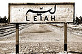 Railway Station ریلوے اسٹیشن Layyah
 -
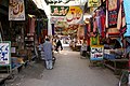 Sadar Bazaar صدر بازار Layyah
 -
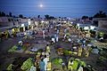 Vegetable and Fruit Market سبزی منڈی of Layyah at twilight
 -
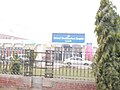 D.H.Q Hospital Layyah, By: Ashiq Hussian Saggu Kot Sultan


Notes
[edit]- ^ 1941 census: Including Ad-Dharmis
- ^ Including Jainism, Buddhism, Zoroastrianism, Judaism, or not stated
References
[edit]- ^ a b c "7th Population and Housing Census - Detailed Results: Table 1" (PDF). Pakistan Bureau of Statistics.
- ^ a b c "7th Population and Housing Census - Detailed Results: Table 12" (PDF). Pakistan Bureau of Statistics.
- ^ a b c d "History of Layyah". Layyahonline.net website. Archived from the original on 5 April 2019. Retrieved 28 April 2024..
- ^ "Climate | Layyah". layyah.punjab.gov.pk.
- ^ "District And Tehsil Level Population Summary" (PDF). Pakistan Bureau of Statistics, Government of Pakistan website. Archived from the original (PDF) on 25 December 2018. Retrieved 28 April 2024.
- ^ "Three Tehsils of Layyah District". punjab.gov.pk. Punjab Portal. Retrieved 20 November 2019.
- ^ Divisions/Districts of Pakistan Archived 2006-09-30 at the Wayback Machine Note: Although divisions as an administrative structure has been abolished, the election commission of Pakistan still groups districts under the division names
- ^ "TABLE 1 : AREA, POPULATION BY SEX, SEX RATIO, POPULATION DENSITY, URBAN POPULATION, HOUSEHOLD SIZE AND ANNUAL GROWTH RATE, CENSUS-2023, PUNJAB" (PDF).
- ^ a b "Pakistan District Education Rankings 2017" (PDF). elections.alifailaan.pk. Alif Ailaan. Retrieved 20 November 2019.
- ^ "D.G. Khan list of colleges" (PDF). Higher Education Department, Government of The Punjab.
- ^ "In homegrown innovation, Sehar village rises above flood woes". DAWN.COM. 16 November 2015.
- ^ Correspondent, The Newspaper's (23 July 2015). "Fight against fury as Layyah's 382 villages inundated". DAWN.COM.
{{cite web}}:|last=has generic name (help) - ^ Haider, Dawn com | Irfan (21 July 2015). "Relief operations under way in flood-hit areas". DAWN.COM.
{{cite web}}: CS1 maint: multiple names: authors list (link) CS1 maint: numeric names: authors list (link) - ^ "Population by administrative units 1951-1998" (PDF). Pakistan Bureau of Statistics.
- ^ "7th Population and Housing Census - Detailed Results: Table 5" (PDF). Pakistan Bureau of Statistics.
- ^ a b "7th Population and Housing Census - Detailed Results: Table 9" (PDF). Pakistan Bureau of Statistics.
- ^ "CENSUS OF INDIA, 1941 VOLUME VI PUNJAB PROVINCE". Retrieved 21 July 2022.
- ^ "District Wise Results / Tables (Census - 2017)". www.pbscensus.gov.pk. Pakistan Bureau of Statistics.
- ^ a b "7th Population and Housing Census - Detailed Results: Table 11" (PDF). Pakistan Bureau of Statistics.
30°57′37″N 70°56′32″E / 30.9602°N 70.9423°E
Provincial capital: Lahore | ||
| Bahawalpur |  | |
| Dera Ghazi Khan | ||
| Faisalabad | ||
| Gujranwala | ||
| Gujrat | ||
| Lahore | ||
| Mianwali | ||
| Multan | ||
| Rawalpindi | ||
| Sahiwal | ||
| Sargodha | ||
| International | |
|---|---|
| National | |