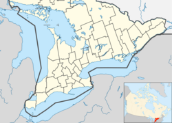
Sarnia
Appearance
Sarnia | |
|---|---|
City (lower-tier) | |
| City of Sarnia | |
 | |
| Nickname: The Imperial City | |
| Motto(s): Sarnia Semper (Latin for "Sarnia Always") | |
| Coordinates: 42°58′53″N 82°19′04″W / 42.98139°N 82.31778°W[1] | |
| Country | |
| Province | Ontario |
| County | Lambton |
| Settled | 1830s |
| Incorporated | 19 June 1856 (town) |
| Incorporated | 7 May 1914 (city) |
| Government | |
| • Mayor | Mike Bradley[2] |
| • Governing Body | Sarnia City Council |
| • MPs | Marilyn Gladu (CPC) |
| • MPPs | Bob Bailey (OPC) |
| Area | |
| • City | 163.90 km2 (63.28 sq mi) |
| • Metro | 1,118.65 km2 (431.91 sq mi) |
| Elevation | 180.60 m (592.52 ft) |
| Population (2021)[3] | |
| • City | 72,047 (83rd) |
| • Density | 439.6/km2 (1,139/sq mi) |
| • Metro | 97,592 (44th) |
| Forward sortation area | |
| Area codes | 519, 226 and 548 |
| Website | www |
Sarnia is a city in Southwestern Ontario, Canada. It had a 2021 population of 72,047. It is the largest city on Lake Huron and in Lambton County. It is near the St. Clair River.[6]
Media
[change | change source]
References
[change | change source]- ↑ "Sarnia". Geographical Names Data Base. Natural Resources Canada.
- ↑ Sarnia, City of. "Mayor Mike Bradley". City of Sarnia. Retrieved 2025-02-20.
- ↑ 3.0 3.1 "Profile table, Census Profile, 2021 Census of Population - Sarnia, City (CY) [Census subdivision], Ontario". Canada 2021 Census. Statistics Canada. 9 February 2022. Retrieved 25 August 2022.
- ↑ "Census Profile, 2021 Census – Sarnia (Census agglomeration), Ontario and Lambton, County (Census division), Ontario". Canada 2021 Census. Statistics Canada. 8 February 2017. Retrieved 29 August 2023.
- ↑ "National Climate Data and Information Archive, 1971–2000". Government of Canada. Retrieved 12 April 2012.
- ↑ "La Salle and the Griffon". Retrieved 23 August 2013.


